One of the desired qualities in students is a good outlook. Come with us to expand it with the viewpoints around Pilsen!
In this article you’ll find four tips for walks that will give you a different perspective of the West Bohemian capital.
With a gas mask to Mikulka
Distance: 1,8 km
Map link: https://mapy.cz/s/bapasobaju
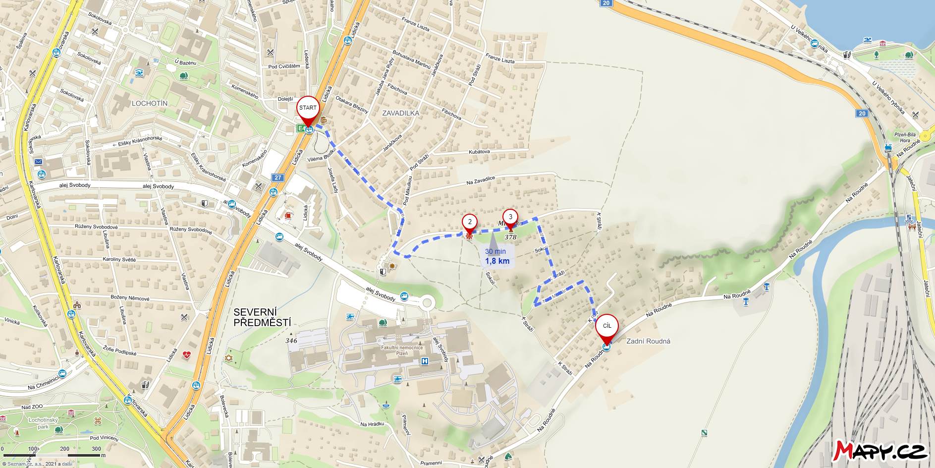
We’ll start lightly, just outside the center. From the Mozartova tram stop number 1, follow the street of the same name into the heart of the Zavadilka district. After a while, you’ll come to the interesting building of the Czech Hydrometeorological Institute – an institute whose name we can or cannot be able to pronounce. The building is interesting because of its glass part with a circular ground plan, from which the employees of the institute have a wide view of Pilsen.
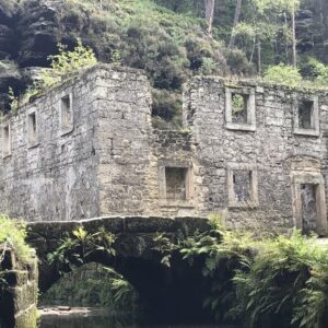
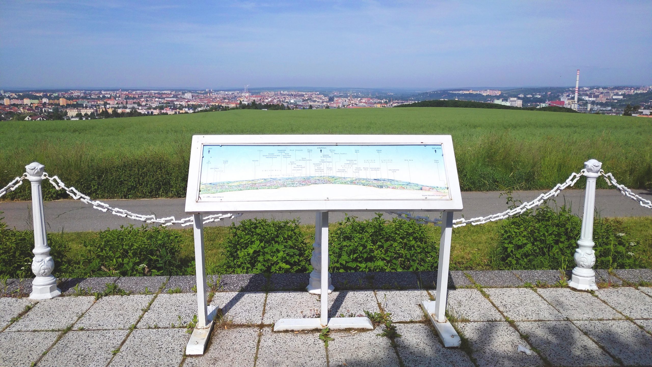
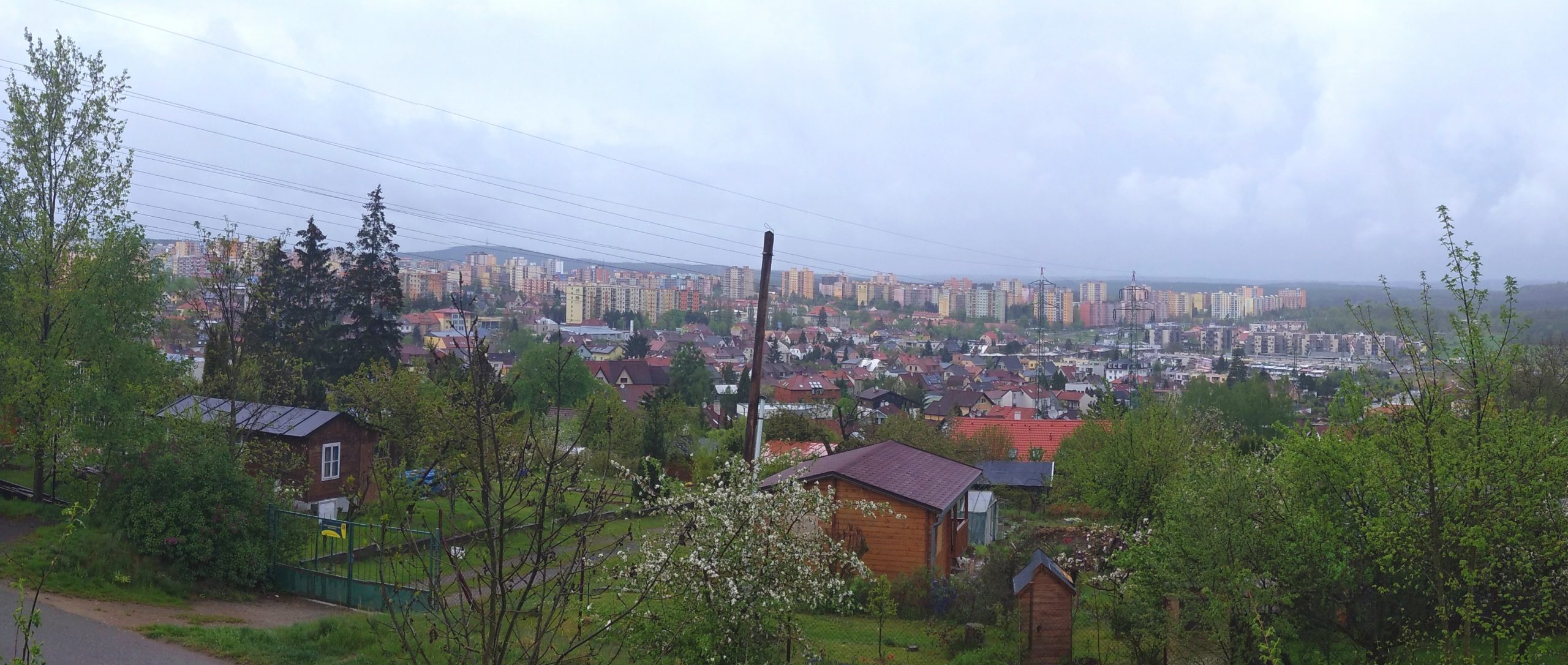
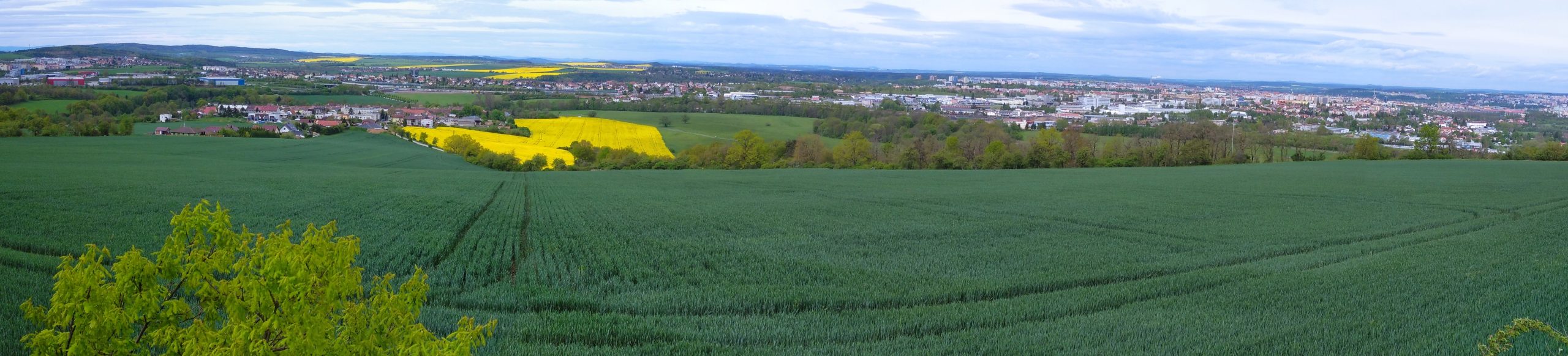
But you won’t have that easy access to the view. From the institute you will take a muddy path towards the garden colony and Mikulka Hill. After a while, you’ll come across the concrete ruins of a former civil defence observation post. The place has deteriorated considerably since the days when you’d come here during exercises wearing a gas mask and observe whether some imperialist was planning to nuke Pilsen. Compared to the Cold War era, the surrounding trees also block the view much more. Even so, from the top of the bunker you can see a large part of Pilsen, especially the Great Bolevec Pond (Velký Bolevecký rybník), Bolevec, the area of the Lochotín Hospital, Štrunc Park (Štruncovy sady) or the city centre.Between the gardens, you can go downhill to the V Ráji bus stop, where bus number 20 will pick you up.
Letkov a viewpoint na Švábinách
Distance: 8,3 km
Map link: https://mapy.cz/s/lugofukoho
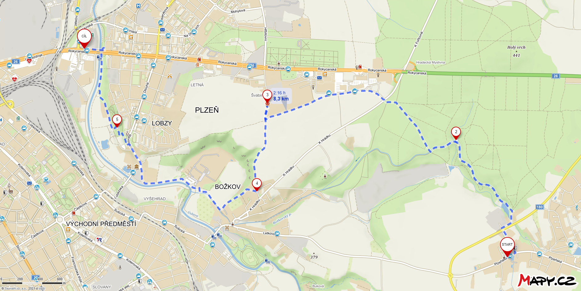
Another viewpoint is located on the very outskirts of Pilsen near the Rokycanská shopping centre, but I recommend you start your trip even further away – in Letkov. You can reach the Letkov stop comfortably by trolleybus number 12, which runs several times during the weekday. But don’t forget to buy a ticket for zone V at the Božkov stop! Letkov is not in the Pilsen zone.
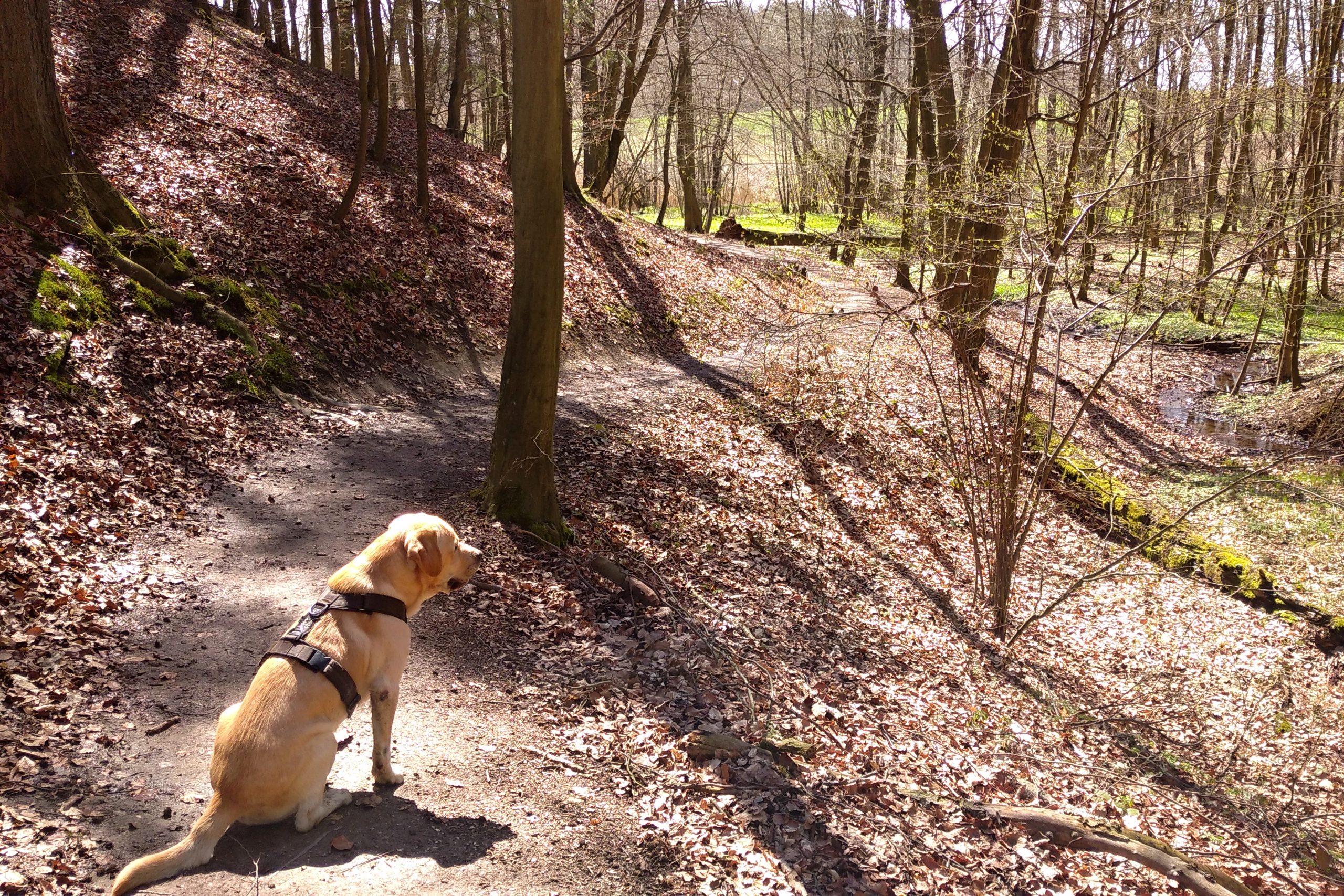
Just beyond Letkov, you will enter a quiet forest and follow the stream, which is watering the surrounding ponds, back to Pilsen. The forest is crossed with paths and it is definitely worth leaving the main, paved path anywhere and walking along the paths between the fallen trees and little ponds.
In the middle of the forest you’ll also find a shelter that invites you to have a snack and rest. You’ll leave the forest a short distance from the mentioned shopping centre and continue along the field to Švábiny, where you’ll find the famous viewpoint. There you’ll have almost the whole Pilsen from Černice to Bolevec in front of you.If you have enough strength left, go downhill to Božkov and along the Úslava River to Lobezský Park. On the way you can soak your feet in the river or sit on a bench in the park. Along the Úslava you will reach Rokycanská Street and the Alfa Theatre, where you can get on trolleybus number 11 or 15.
To Green Grove
Distance: 5,9 km
Map link: https://mapy.cz/s/dafonetevo
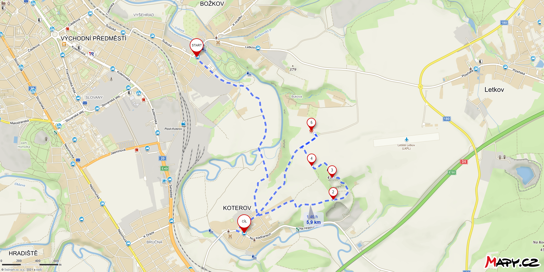
Just a short distance from Švábiny you`ll find a viewpoint on the Háje hill above Koterov. Although this hill has probably escaped your eye so far, its green cap is visible from a wide area.
You can walk comfortably to Koterov from Božkov from the final trolleybus 12 stop. At the end of Koterov, you’ll climb a steeper hill for city standards and circle the Háje hill, where you’ll find the first viewpoint of this route. From there you can see the Radyně and Starý Plzenec. A little beyond the viewpoint is another viewpoint from a concrete bunker. After the excursion to Mikulka, you will probably not be surprised to find out that there used to be a civil defence observation post here as well. Thirdly, visit the viewpoint by the road connecting Koterov with Letkov. From the second and third viewpoint you will see mainly Božkov, Slovany, the adjacent districts and the surrounding fields with oilseed rape.
You can then walk comfortably back to Koterov by road, where buses from Slovany regularly arrive.
Get your legs ready and go to Krakavec
Distance: 8,1 km
Map link: https://mapy.cz/s/homotoropu
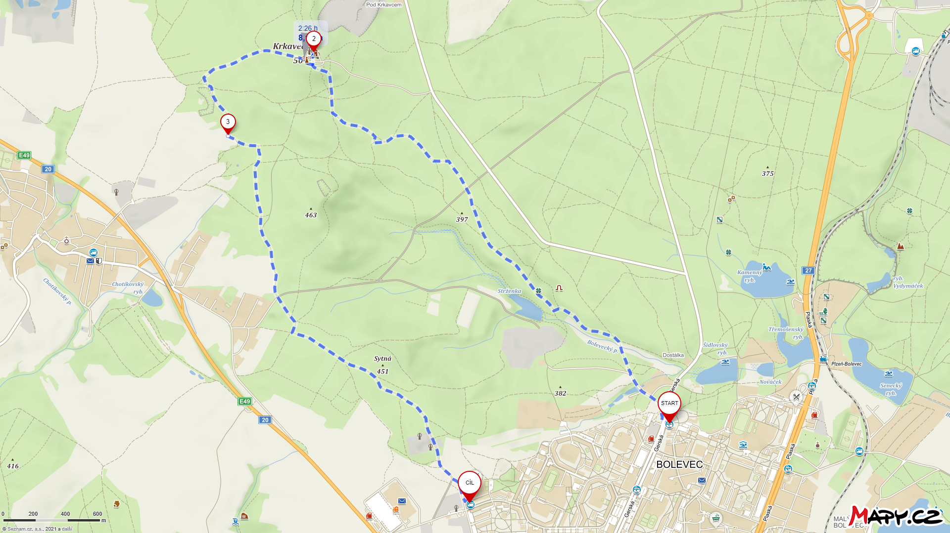
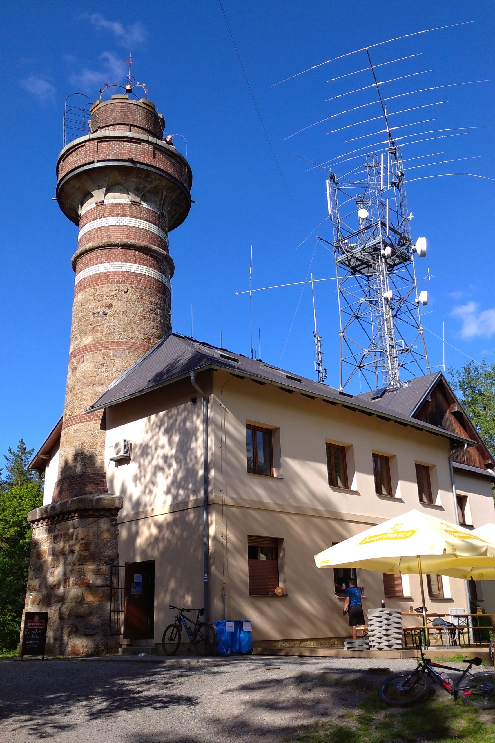
It wouldn’t be an article about viewpoints if I didn’t mention the hill, the lookout tower and the Krkavec transmitter. It is on Krkavec that you can make an exception and climb a few metres above the ground to the stone lookout tower, from where you can see the northern part of Pilsen in the distance above the treetops.
Start from the Košutka stop, where tram number 4 ends its route. Take the comfortable path through the forest, firstly along the yellow tourist sign, later on the red tourist sign. The path will slowly ascend, but save your strength for the last few hundred metres, where the climb will mercilessly increase in intensity.
After four pleasant kilometres, you can enjoy the view from the mentioned tower or refresh yourself at the serving hatch.
Then your path will lead you to the other side of the hill towards Chotíkov. Before the end of the forest, you will turn back towards Pilsen and follow the blue marked trees until you almost reach the edge of the city. Towards the end of the trail, you will disconnect from the marked path and end your trip at the bus stop Sídliště Košutka, where you can take, for example, bus number 30.