Are you tired of tips for a walk to Borský park, along the cycle path along Radbuza river or the Kilometrovka Alley? Don’t worry, you won’t find anything like that in this article. On the contrary, the article will offer you a few lesser-known places to go after a long day at school or after a tough exam.
All the tips have a few things in common: most of them are in the Pilsen land register, most of the route will be in nature, and plus there will be plenty to watch along the way. Plus, the destinations are only a few public transport stops from the city center!
From Homolka to Radobyčice
Distance: 4,4 km
Map link: https://mapy.cz/s/magamupuvu
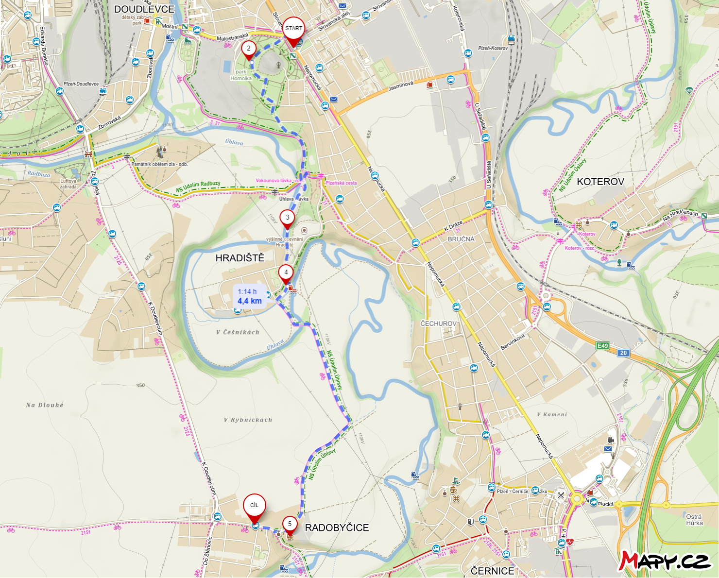
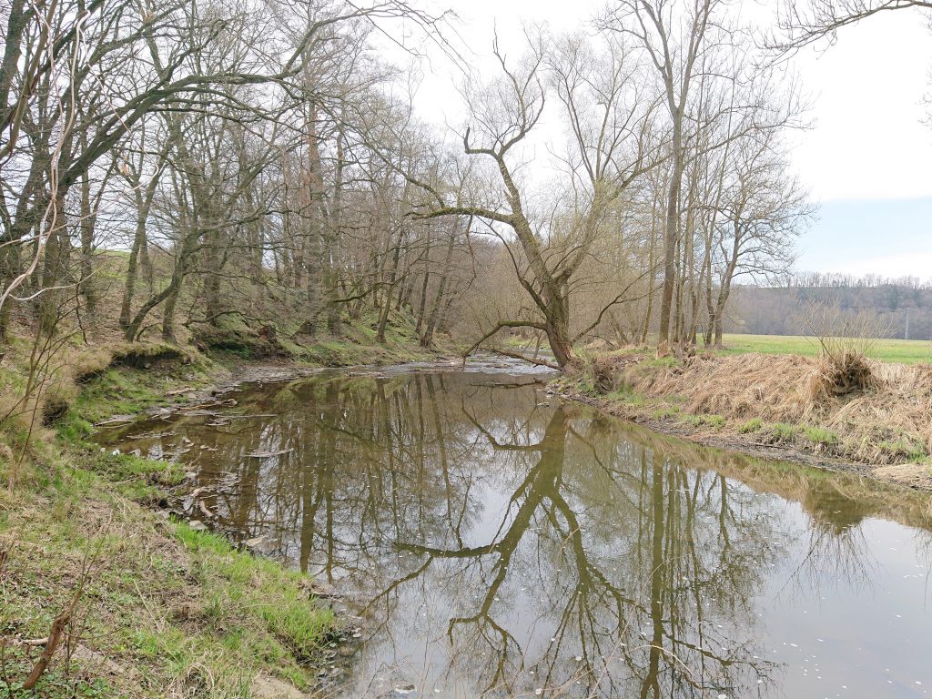
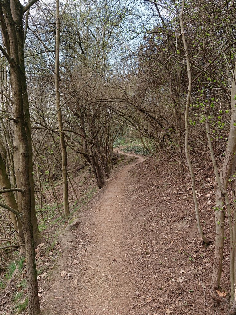
The route starts in Slovany, at the tram no. 1 final stop, and goes through the Homolka forest park to the bank of Úhlava river. After a while you reach the remains of the prehistoric fortifications of Hradiště and the eponymous part of Pilsen, will offer you a seat at the weir with refreshments at the nearby swimming pool. Then your steps will be directed on a paved path across the field toward the Radobyčice.
At the beginning of the village Radobyčice you pass the local brewery and a little further you pass the bus stop Radobyčická náves (line 32).
The route is suitable for runners and dog walkers, with a little improvisation around Vokoun’s footbridge and the fortifications of Hradiště is suitable also for cyclists. You can roller skate from Hradiště to Radobyčice.
Tip: I recommend going the other way on weekends – there is only one bus per hour to Radobyčice.
On cones between Bolevec and Senco
Distance: 6,2 km (variant 1), 6,4 km (variant 2)
Map link: https://mapy.cz/s/gezeveguku (variant 1), https://mapy.cz/s/nepahalake (variant 2)
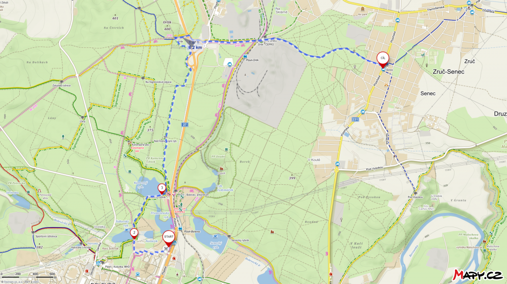
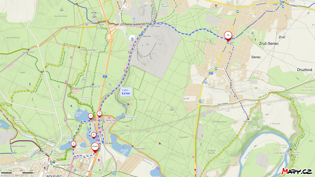
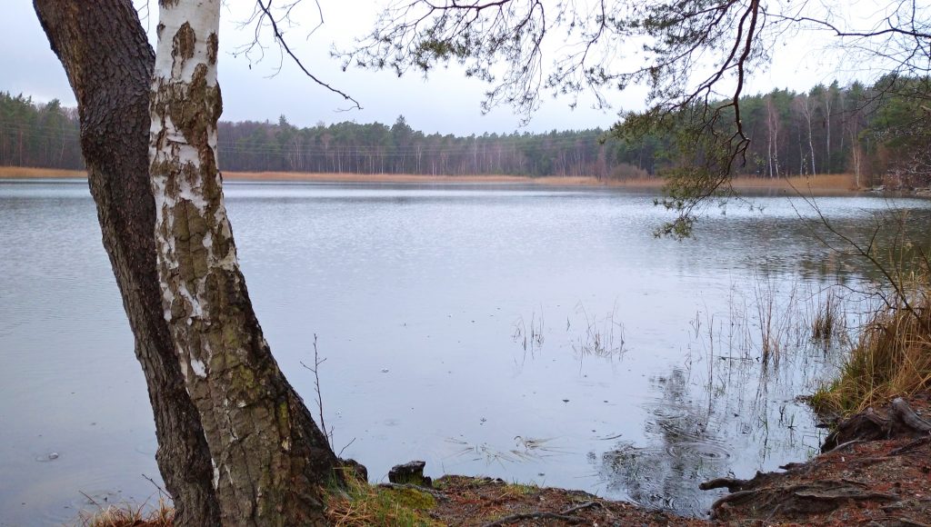
This time the trip starts on the opposite side of the city at the Bolevec stop (tram No 1). From the tram loop, you will walk between the last houses in Pilsen and connect to the so-called Sigmond trail, leading through part of the system of Bolevec ponds. You will walk around the Šikovský and Kamenný ponds, where you can sunbathe on the beach or swim in summer.
Then you have two options. In the first case, you will continue into the forest, disconnect from the trail and follow the green triangles that will take you through the forest to the Orlík crossroads, from where you will follow the blue tourist route towards the railway station.
In the second case, you’ll have to go back a bit, go around the third pond (Třemošenský) and cross the main road to connect to the bike path. Choose this option, especially if you like trains; you’ll walk right along the line.
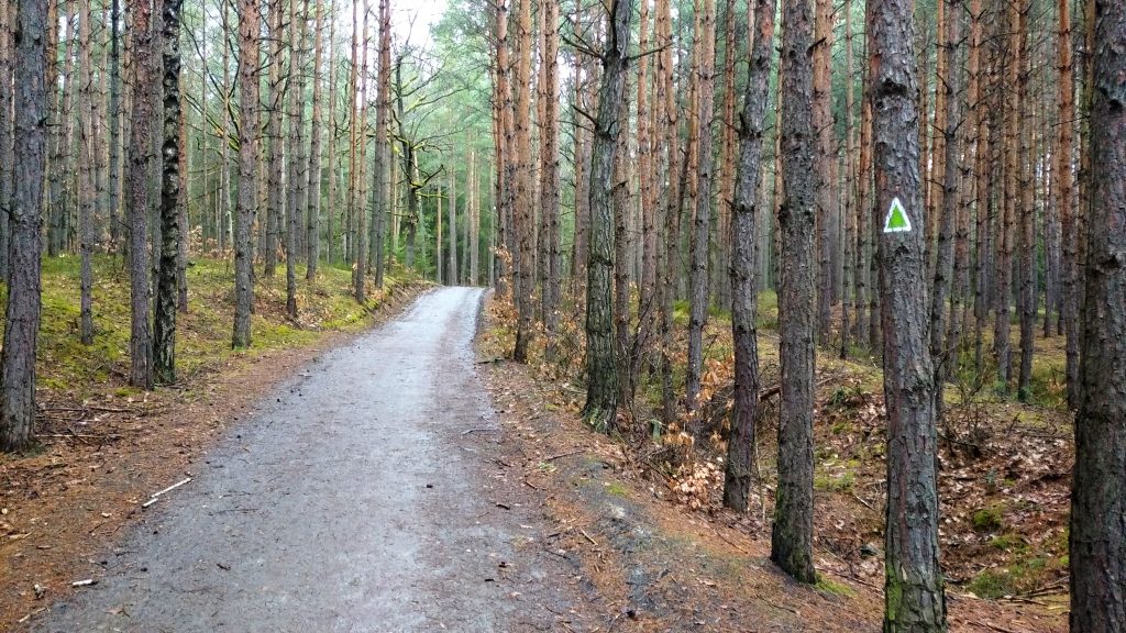
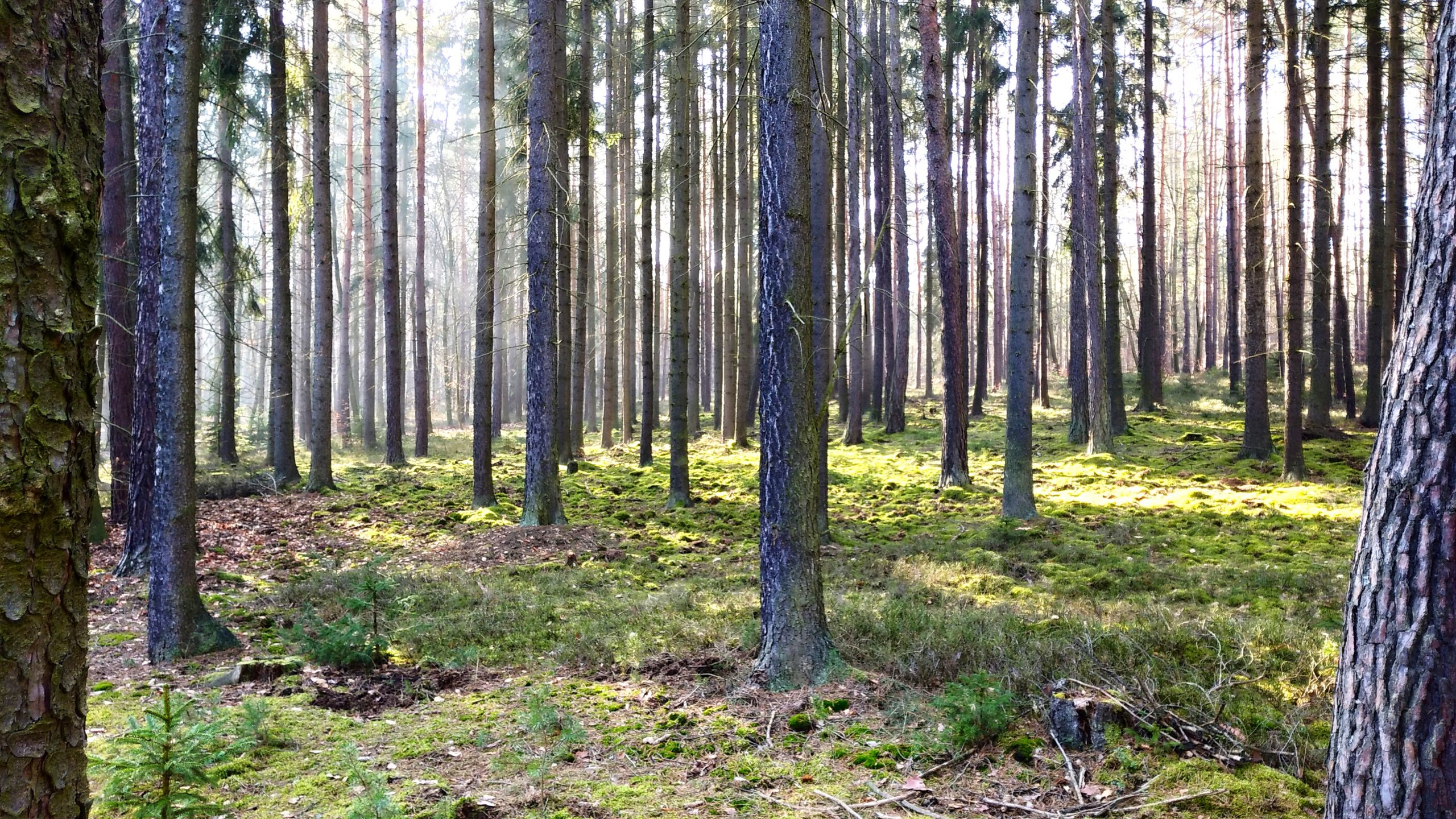
From the Plzeň-Orlík railway station, you will follow the blue tourist route and walk through a wide pine wood. There you can make your trip better, for example, by collecting cones.
If you have the feeling that the few random people you meet while walking are too much unwanted company, you can leave the marked route and use any nearby forest path.
The trip will then end at the Zruč-Senec stop, at Drudíků, where a regular bus or public transport (line 20) will take you back to Pilsen.
From Malešice to Vinice, through the ruins of Kyjov and Malešice rock
Distance: 8,2 km
Map link: https://mapy.cz/s/madedohera
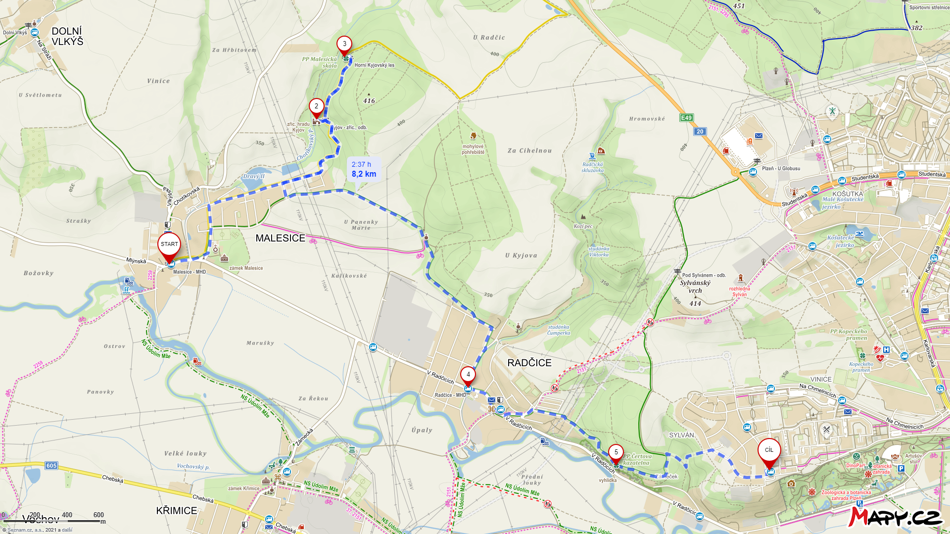
Another great idea for walks in the Pilsen land registry is the route from Malesice to Radčice and Vinice. At the end of Malesice, you slip into the adjacent Upper Kyjov Forest. You won’t get lost because the road is marked by a yellow tourist route.
Along that path, through the beautiful forest, you will get to the remains of the ruins of Kyjov Castle. The monument’s appearance perfectly corresponds to the ruin’s status, so expect no more than the remains of the perimeter stone walls. From the platform on which the castle used to stand, you will have a magnificent view of both the forest and the surrounding fields.
The path continues to the natural monument Malešická rock. From Malešická rock you can continue or return to the beginning of Malesice, where you will connect to the green tourist route. It takes you through the fields to Radčice, where the “weaker pieces” can finish the trip. If you have enough strength left, I definitely recommend you to continue on up the green tourist route to the natural monument Devil’s Pulpit. The path will take you over a high cliff with a beautiful view of Pilsen and the river Mže.
After a while going between the pines, you reach the Vinice housing estate and the equally named public transport stop, the final bus number 41.
No man’s land from Valcha to Bory
Distance: 5,6 km
Map link: https://mapy.cz/s/bonelumoza
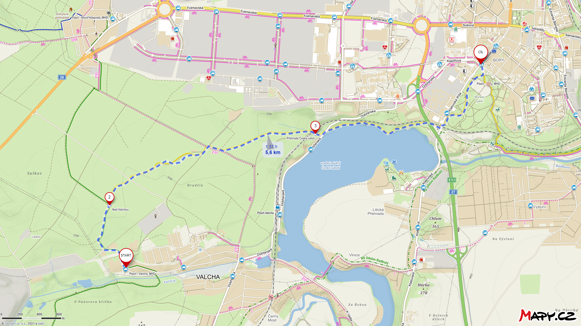
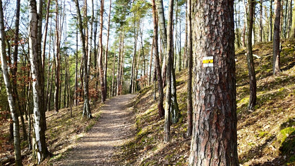
Start at the edge of Valcha at the eponymous bus stop number 26 and follow the green tourist route. Right at the start, the trail takes you to the forest, where you hardly meet anyone. Although you will still be in Pilsen, you will only hear the rustling of the forest and the singing of birds.
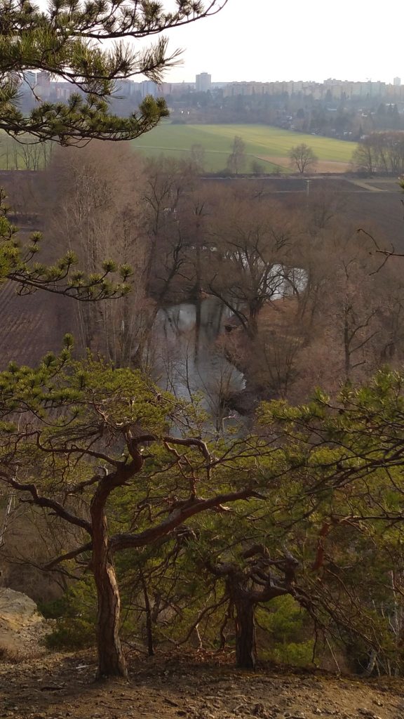
At the crossroads “Nad Valchou” you will turn onto a yellow marked route, which you will then follow until the end of the trip. The pleasant forest path halfway is replaced by paved road, which can also be reached by bicycles and prams. From there, the route will take you to the reservoir České údolí, whose coast you will follow for about a kilometer.
At the end of the walk you reach the busy Borský park. Nevertheless, I guarantee, if you like the forest and quiet, especially the start of the route, you’ll love it.
Tip: You can shorten the route. Where the yellow tourist route crosses the main road by the reservoir, it is possible to park a car. From there you can go straight to the forest.
If your legs are already aching looking at the length of the routes, don’t despair. All routes can be shortened significantly with a little imagination. There is, on the other hand, plenty of room for extension and improvement for passionate hikers. Anyway, know that Pilsen offers a great variety of places to go to vent your head, and it would be a shame not to use them!